
Snow is falling, all around me.. but is it? Will it? Will we get the Christmas card Christmas this year?
Well, in three words, We don’t know. Forecasting specifics on specific days at this range is impossible, but we can get an idea of what the broad scale patterns are likely to be doing and from there, predict what *may* happen on a more local scale over the Christmas period.
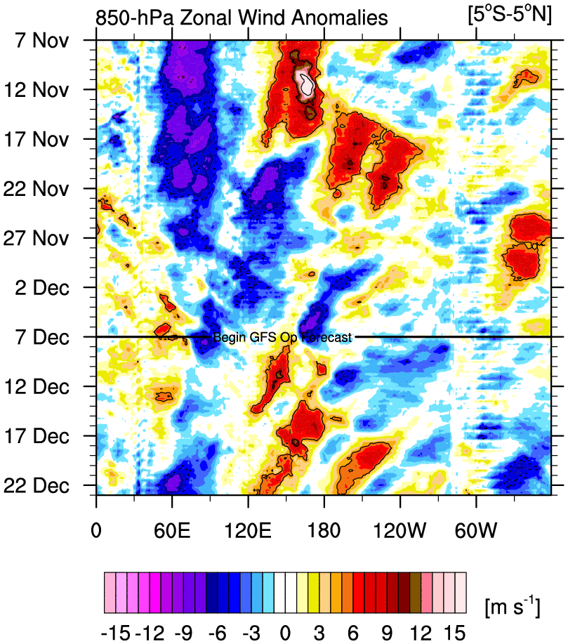
Firstly, we have to look at the Specific Pacific Ocean. The MJO, an area of convection has been pushing eastward across the Maritimes out of the Indian Ocean. This increase in westerly winds & convection across the Pacific disrupts the jet stream, these disruptions then travel downstream across America and into the Atlantic, eventually impacting our weather. With this in mind, it seems likely we’ll see an increased likelihood of blocking patterns around the Christmas period.
This graphic from the ECMWF 46day forecast shows the expected broader pattern across the Atlantic sector.
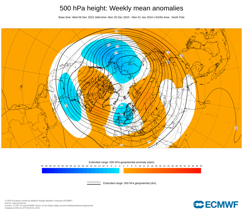
The orange represents higher pressure and the blue represents lower pressure. Broadly, the model predicts lower pressure to the east of the UK and higher pressure up into Greenland and Canada, winds would generally be from a northerly or north-westerly direction.
So.. the Christmas period does look like it’ll be colder than average at this early stage and with cold air does come the potential for snowfall.
Exact timing and positioning of this pattern is yet to be determined however; Current indications suggest a higher chance than normal of snowfall this Christmas period but a slower evolution may shift any snow risk beyond the Christmas period.
We’ll keep you updated in the coming days & weeks.
Recent comments