
Halloween and bonfire night have passed us and we find ourselves once again looking ahead towards winter. Will it be mild and wet? Will it be cold and dry? Will we spend 10 minutes each morning trying to find the ice scraper only to make do with a credit card and frozen fingers?
December, statistically speaking is the mildest month of the winter but this year there are processes going on which may bring some early winter cold spells and dare I say it.. potentially, some snow.
→ MJO
The madden Julian Oscillation is an area of thunderstorms or rainfall which circles the tropics over a time period of 30-60 days on average, the location of this system is important because it can interact with the jet stream leading to changes in weather patterns further afield.
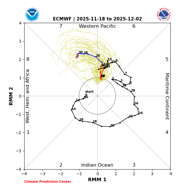
The MJO has been cycling through phases 4, 5 and into 6 over the past few weeks or so and this could have impacts on our weather going into December.
In short, phases 6 and 7 typically favour more blocking areas of high pressure and a ‘wavey’ jet stream, if we find ourselves to the west of these high pressure systems we could see cold, Arctic air moving south across the UK, indeed, that’s what’s unfolding during the current week.
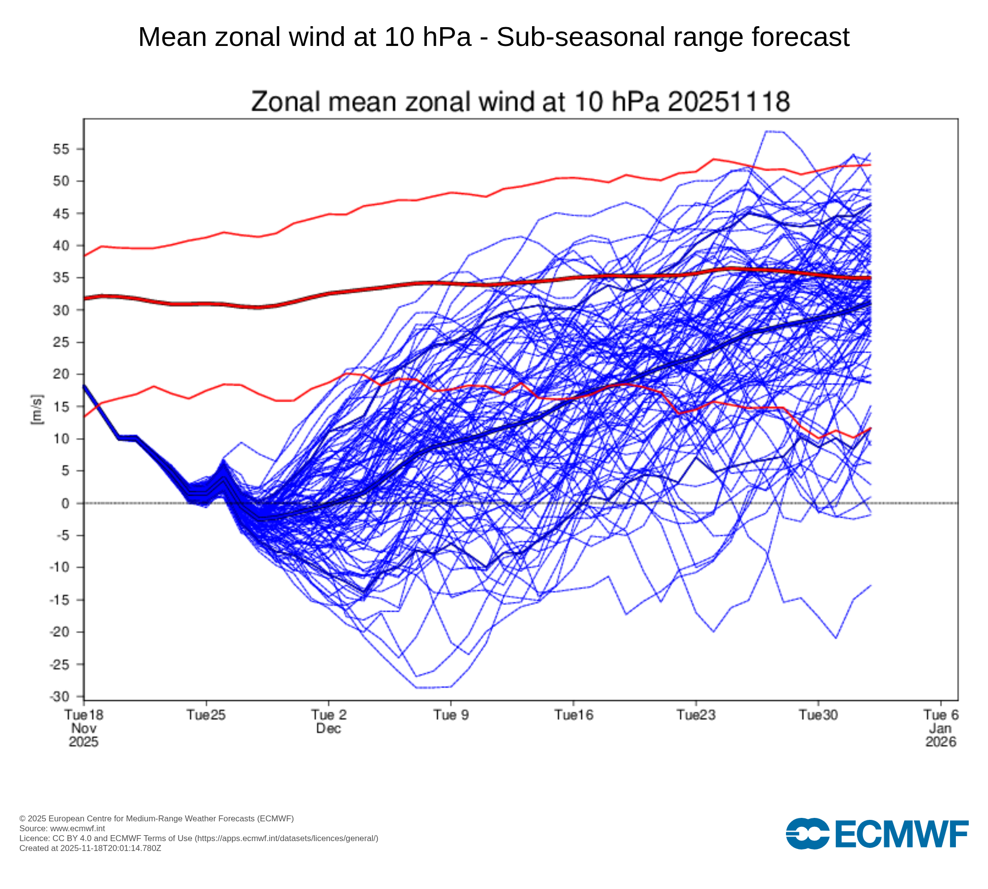
→ Stratospheric Polar Vortex
This is a topic that many of us discuss each winter, the polar vortex forms over the Arctic every winter due to the thermal gradient increase between the Arctic and the tropics. It’s a vast area of strong westerly winds which can have consequences on our weather patterns.
Currently we’re expecting a very weak vortex as we go through December which means it will have little impact on the weather patterns at the surface. A strong polar vortex increases the likelihood of wet and mild weather, equally, a weak vortex can increase the likelihood of colder, drier weather.
When it comes to forecasting the weather a couple of weeks or even a month ahead it’s impossible to be detailed, we can’t tell you what the weather will be doing on December 11th, for example. We can however get an idea on the most likely weather patterns for a given time, i.e 1st – 16th December.
Given the above (and various other drivers of our weather not mentioned) we can be fairly confident of a few things;
- The usual westerly, Atlantic weather is less likely than normal during December
- Blocking patterns are more likely than normal during December
Predicting precise detail this far out is impossible but if westerly Atlantic weather is less likely and blocking patterns are more likely, we can, while urging on the side of caution, suggest that December has potential to be a below average month with cold weather patterns becoming established leading to an increased likelihood of cold & snow.
Clearly, we’re not looking at a “typical” December in terms of patterns across the Northern Hemisphere, while this doesn’t guarantee the UK will see cold weather during December, the risk is higher than it normally would be and certainly much higher compared to recent, very mild years.
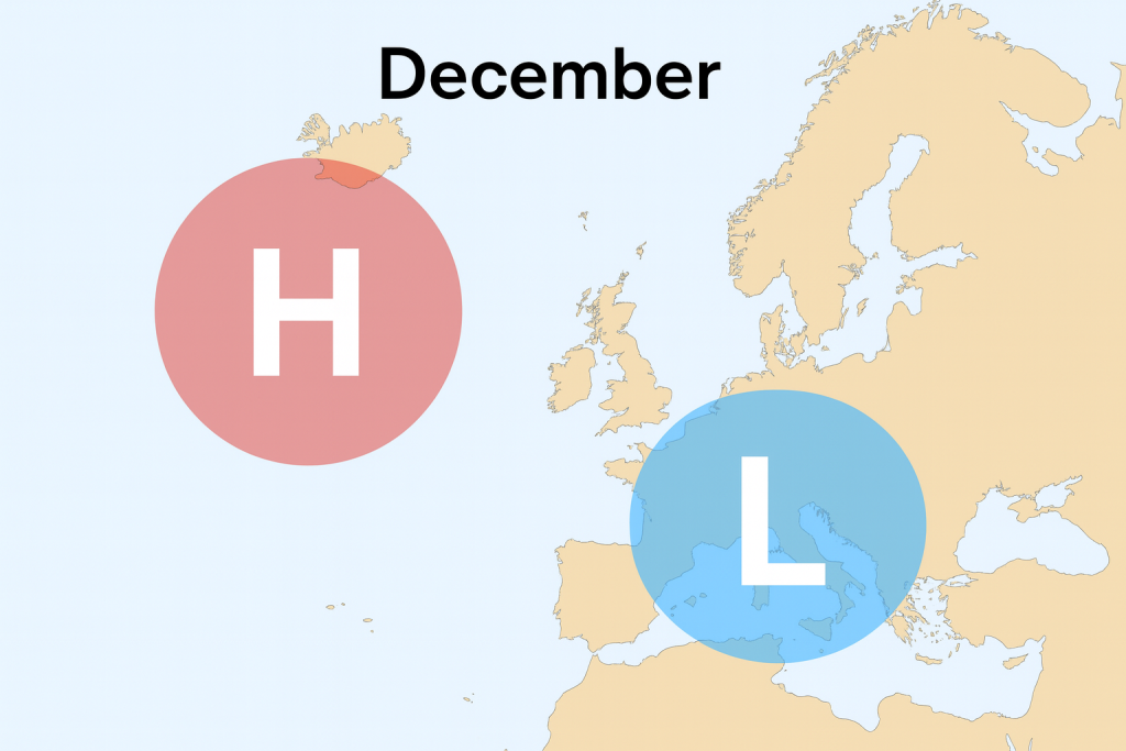
The above shows our current thinking on the most likely pressure pattern during December with winds generally from the north or northeast, that doesn’t however rule out brief Atlantic westerly periods.
We’ll of course keep you updated on developments over the coming weeks.